
Title
Creation Date
Fall 9-26-2022
Description
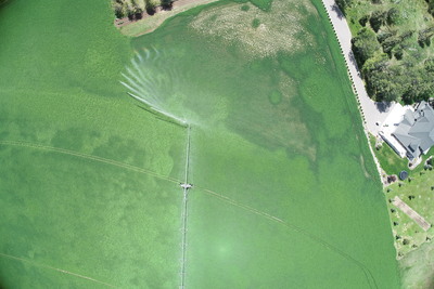
Honorable Mention Photo was taken from a drone 400 feet in the air. This is at our research site in Rexburg, Idaho. We are using the drone to help delineate the alfalfa field into variable rate irrigation management zones. Different parts of the field require different needs of water. This is a way to save thousands of gallons of water each year by watering more responsibly.
Preview
Keywords
Drones, Agriculture, Variable Rate Irrigation, Pivot