
Files
Download Full Text (752 KB)
Keywords
urban heat islands, socioeconomics, GIS, income, temperature, climate change
Abstract
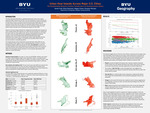
The urban heat island (UHI) effect is a geospatial phenomenon prevalent across major U.S. cities which has significant implications for public health, energy consumption, and environmental quality. To better understand the impacts of UHI on various communities, we analyzed the correlation between surface heat temperatures and median household income across five large cities and three urban climates (arid, humid, and tropical) in the U.S.. We gathered data from the U.S. Census Bureau and other sources to create maps using ArcGIS Pro. Based on the maps and statistical analysis, UHI intensity is correlated with socioeconomic status. Further research is recommended to better understand the other aspects affecting UHI intensity and to develop better strategies for UHI mitigation.
BYU ScholarsArchive Citation
Irish, Sarah; Hammari, Eliza; and Green, Megan, "Urban Heat Islands Across Major U.S. Cities: The Relationship Between Surface Temperature & Socioeconomic Status" (2025). FHSS Mentored Research Conference. 365.
https://scholarsarchive.byu.edu/fhssconference_studentpub/365
Document Type
Poster
Publication Date
2025-04-11
Language
English
College
Family, Home, and Social Sciences
Department
Geography
Course
Geography 311
Copyright Use Information
http://lib.byu.edu/about/copyright/